

A new study reveals that Africa is splitting in two – a process that began millions of years ago. Scientists from Keele University have used magnetic data to detect signs of a geological split between Africa and Arabia.
These two land masses were once connected like pieces of a puzzle, but a gradual process of separation has pulled them apart.
The separation is spreading from northeast to south across Africa, accompanied by volcanic and seismic activity.
According to experts, when the split is complete – perhaps in 5-10 million years – Africa will consist of two land masses.
The largest mass in the west includes the most popular African countries such as Egypt, Algeria, Nigeria, Ghana, and Namibia.
The smaller mass in the east includes Somalia, Kenya, Tanzania, Mozambique, and a large part of Ethiopia.
“These discoveries provide a unique perspective on how our planet is constantly changing and moving beneath our feet,” said Prof. Peter Styles, a geologist at Keele University.
What does the theory of plate tectonics say?
The theory of plate tectonics states that the current configuration of the continents has changed greatly over geological history.
Millions or billions of years ago, the largest tectonic plates broke apart and moved apart, creating new oceanic crust and the oceans we know today. This process is known as seafloor spreading.
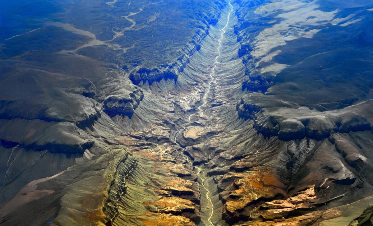
Researchers show that the East African Rift – one of the continent’s largest tectonic features – is causing the slow rifting. With a length of about 6,400 km and an average width of 50-65 km, the system stretches from Jordan in Southwest Asia to Mozambique.
When Africa is completely divided, space will run along this belt, separating large lakes in East Africa, such as Lake Malawi and Lake Turkana.
The critical area of Afar
The study focused on the Afar region, where the Red Sea meets the Gulf of Aden. This is one of the few areas on Earth where three tectonic belts meet: the Ethiopian Main Belt, the Red Sea Belt, and the Gulf of Aden Belt – known as the triple junction.
Scientists believe that in this area we are seeing the early stages of continental drift, a process that began millions of years ago.
Analysis of magnetic data collected in 1968-1969 by airborne instruments showed signs of finite ocean expansion between Africa and Arabia. The magnetic signals indicate that the continent is slowly stretching and thinning, until it breaks off, marking the birth of a new ocean.
Dr. Emma Watts, a geochemist at Swansea University, explains that the process is currently happening, but at a slow pace – around 5-16mm per year in the northern part of the belt. “This process will take several million years to complete,” she said.
Tectonic plates, made up of the crust and the upper layer of the mantle, move on top of the asthenosphere – a warm, viscous layer of rock. Earthquakes occur mainly at plate boundaries, where one moves under another or slides past it. Meanwhile, earthquakes can also occur between plates when old geological faults are reactivated.
The study authors believe that the Afar data provide important insight into the separation of continents and the beginnings of the birth of new oceans, making this region a natural laboratory for understanding the dynamics of the Earth. /GazetaExpress/